Example - Orthomosaic Mapping with BIO Camera
Example - Orthomosaic Mapping with BIO Camera
Become a customer to access all support documents.
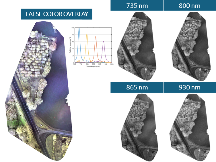
This image set was captured using MSDC-2-4 system equipped with MSC2-BIO-1-A drone camera. The camera was equipped with a 12 mm standard lens with an aperture of f/4.5. Images were collected flying the drone in a grid pattern at an altitude of 158 m (above the sea level) resulting in a field of view of 38 m x 38 m per frame and a ground pixel size of 8.3 cm x 8.3 cm.
Data set consisted of 156 images (512 x 512 px) of each band (735, 800, 865, 930 nm). All image pre-processing and image geotagging was performed using Spectral Devices multispectral batch processing software msInspector. Radiometric calibration was not performed.
The Open Drone Maps software WebODM was used to reconstruct multispectral orthomosaic map. As an output GeoTiff file of the orthomosaic map is provided containing all the spectral bands. For visualization of each spectral band the QGIS software was used.