

Example NDVI Survey (AGRI)
Example NDVI Survey (AGRI)
Become a customer to access all support documents.
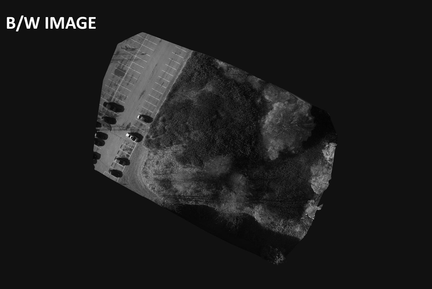
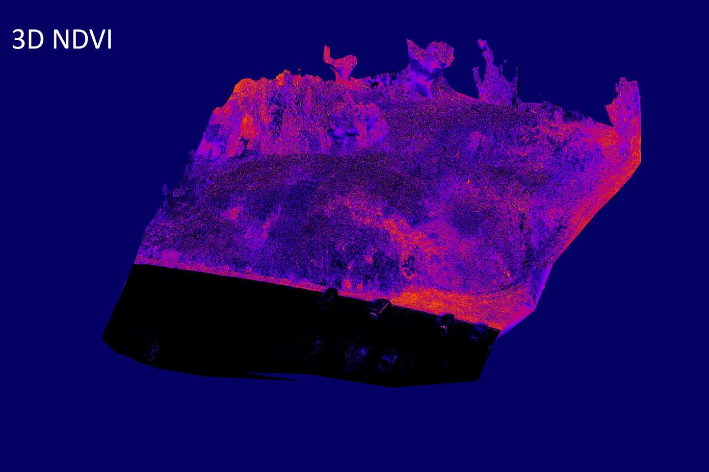
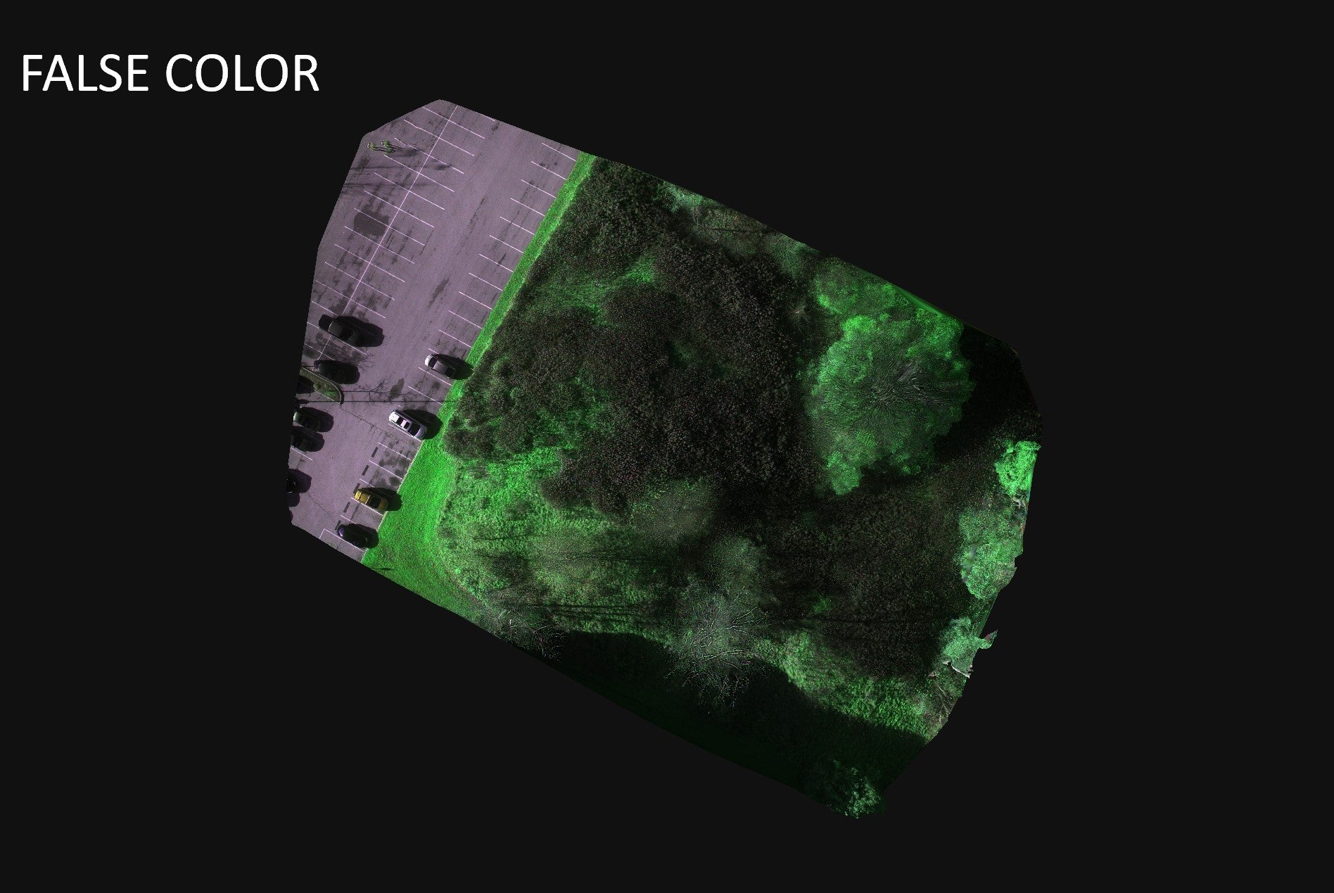
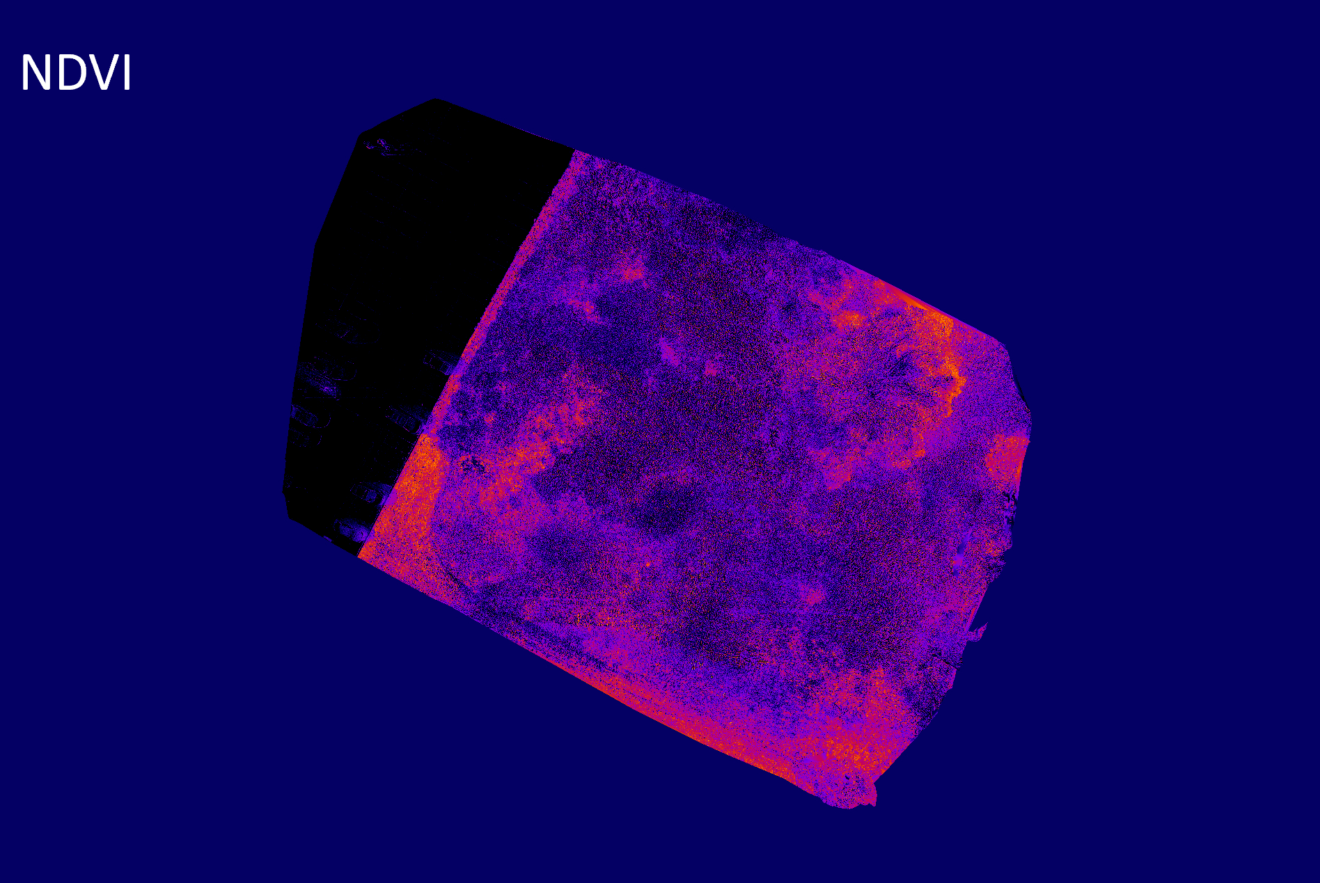
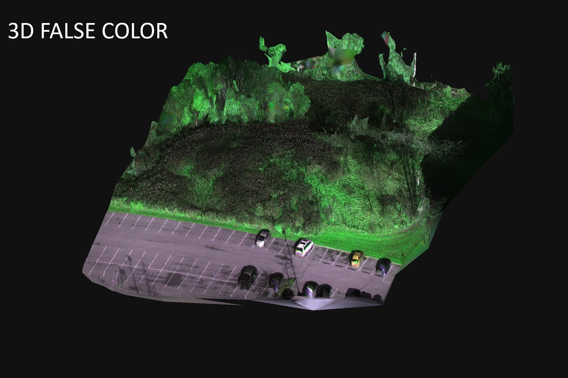
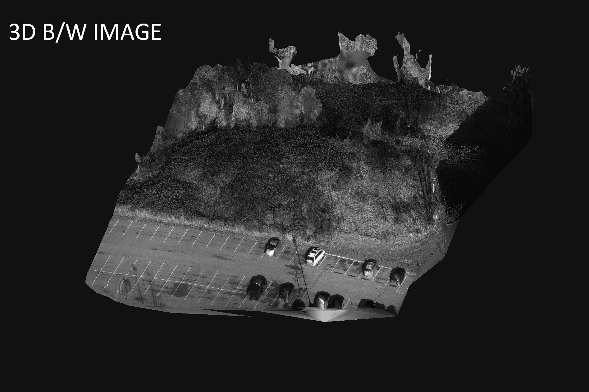
Example of a reconstructed image set collected with an MSDC-AGRI-1-A drone camera. The color and NDVI images represent composites reconstructed from 168 AGRI multispectral images. In this case, a false color image was generated from the 580nm (green), 660nm (red), and 735nm (blue) bands (FALSE COLOR). An NDVI image displayed with a fire look up table shows areas of chlorophyll-rich vegetation in red and vegetation with less chlorophyll in blue (NDVI). NDVI was computed using the NIR (820nm) and Red (660nm) bands. A black and white image computed using all 4 bands (B/W IMAGE). These data were also reconstructed into a 3D model of the terrain with a variety of overlays (3D FALSE COLOR, 3D NDVI, and 3D B/W IMAGE). These overlays highlight the precise co-registration of the various computed data sets. Images were captured every 3m at a flight speed of 5m/s and altitude of 33m. Exposure time was 2.8ms per frame. The camera was fitted with a 16mm standard lens with an aperture setting of f/2.8. The field of view per frame was 23.23m x 23.23m with a ground pixel size of 4.5cm x 4.5cm (2.3cm x 2.3cm debayered). Image processing was performed with Spectral Devices multispectral batch processing software and 3DF Zephyr Lite (3Dflow Srl). All images were down-sampled for web viewing.
View full details